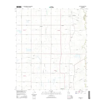
2015 Map of Hathaway
USGS Topo · Published 2015About this map
The agrarian landscape of Jefferson Davis Parish is defined by a grid of rural roads and the meandering courses of the West Bayou Grand Marais and Gum Gully. Small community centers like Raymond, Hathaway, and Panchoville punctuate the Jefferson Davis and Acadia Parish border, serving as hubs for the surrounding farmsteads. The southern edge of the survey captures the northern expansion of Jennings, where the land transitions from open fields to more developed outskirts. For local historians and genealogists, the map identifies several family-named landmarks and resting places, including Bertrand Cem, Doucet Cem, and Miller Cem. The presence of the Tiptop Canal and Middle Bayou Grand Marais illustrates the critical role of water management in this low-lying prairie region, where drainage infrastructure supports the local agricultural economy.
Find a feature on this map
52 named features on this map. Tap any name to fly to it.
Don’t see what you’re looking for? This feature index may not catch every label — zoom into the map to look around manually.
Map Details
Editions of this 2015 Hathaway Map
This is the sole edition of this map. No revisions or reprints were ever made.
Other maps of this area

1946 · Mermentau
USGS Topo · 1:31,680

1946 · Jennings
USGS Topo · 1:31,680

1947 · Evangeline
USGS Topo · 1:31,680

1947 · Kinder
USGS Topo · 1:31,680

1947 · Pine Island
USGS Topo · 1:31,680

1947 · Welsh
USGS Topo · 1:31,680

1947 · Elton
USGS Topo · 1:31,680

1947 · Hathaway
USGS Topo · 1:31,680

1947 · Basile
USGS Topo · 1:31,680

1949 · Basile
USGS Topo · 1:31,680