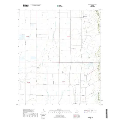
2018 Map of Hathaway
USGS Topo · Published 2018About this map
The low-lying wetlands of Jefferson Davis Parish define this 2018 survey, where the winding courses of West Bayou Grand Marais and Middle Bayou Grand Marais cut through a landscape shaped by drainage and agriculture. These natural waterways are complemented by man-made infrastructure like the Tiptop Canal and Gum Gully, illustrating the long-standing efforts to manage the water levels of this coastal prairie region. The settlement pattern is largely dispersed, centered on small communities such as Hathaway and Raymond.
Find a feature on this map
64 named features on this map. Tap any name to fly to it.
Don’t see what you’re looking for? This feature index may not catch every label — zoom into the map to look around manually.
Map Details
Editions of this 2018 Hathaway Map
This is the sole edition of this map. No revisions or reprints were ever made.
Other maps of this area

1946 · Mermentau
USGS Topo · 1:31,680

1946 · Jennings
USGS Topo · 1:31,680

1947 · Evangeline
USGS Topo · 1:31,680

1947 · Kinder
USGS Topo · 1:31,680

1947 · Pine Island
USGS Topo · 1:31,680

1947 · Welsh
USGS Topo · 1:31,680

1947 · Elton
USGS Topo · 1:31,680

1947 · Hathaway
USGS Topo · 1:31,680

1947 · Basile
USGS Topo · 1:31,680

1949 · Basile
USGS Topo · 1:31,680