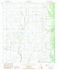
1985 Map of Hathaway
USGS Topo · Published 1985About this map
Jefferson Davis Parish rice and oil country is defined by an intricate network of irrigation and transport infrastructure in the mid-1980s. The landscape around Hathaway and Raymond is characterized by a sophisticated system of agricultural water management, including the Tiptop Canal and numerous flumes and siphons used to flood the surrounding fields. The natural drainage of Nezpique Bayou on the eastern edge of the quadrangle contrasts with the engineered waterways like West Bayou Grand Marais and Middle Bayou Grand Marais. Small rural settlements like Panchoville are interspersed with industrial and utility markers, including a radio tower, a Sand Pit, and double wooden pole power lines. This survey captures the region just before significant changes in modern agricultural technology, documenting a period when localized pumping stations and a landing strip were vital components of the rural economy.
Find a feature on this map
21 named features on this map. Tap any name to fly to it.
Don’t see what you’re looking for? This feature index may not catch every label — zoom into the map to look around manually.
Map Details
Editions of this 1985 Hathaway Map
This is the sole edition of this map. No revisions or reprints were ever made.
Other maps of this area

1946 · Mermentau
USGS Topo · 1:31,680

1946 · Jennings
USGS Topo · 1:31,680

1947 · Evangeline
USGS Topo · 1:31,680

1947 · Kinder
USGS Topo · 1:31,680

1947 · Pine Island
USGS Topo · 1:31,680

1947 · Welsh
USGS Topo · 1:31,680

1947 · Elton
USGS Topo · 1:31,680

1947 · Hathaway
USGS Topo · 1:31,680

1947 · Basile
USGS Topo · 1:31,680

1949 · Basile
USGS Topo · 1:31,680