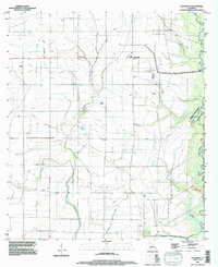
1994 Map of Hathaway
USGS Topo · Published 1996About this map
Hathaway and the surrounding agricultural lands of Jefferson Davis Parish are defined by a complex network of waterways and irrigation infrastructure mid-way through the 1990s. The landscape is dominated by the meandering course of Bayou Nezpique along the eastern boundary, while the interior is drained by West Bayou Grand Marais, Middle Bayou Grand Marais, and the seasonal flow of Gully Gum. The integration of man-made features like the Tiptop Canal and various unnamed wells and pipelines illustrates the region's reliance on water management for its rural economy.
Find a feature on this map
14 named features on this map. Tap any name to fly to it.
Don’t see what you’re looking for? This feature index may not catch every label — zoom into the map to look around manually.
Map Details
Editions of this 1994 Hathaway Map
This is the sole edition of this map. No revisions or reprints were ever made.
Other maps of this area

1946 · Mermentau
USGS Topo · 1:31,680

1946 · Jennings
USGS Topo · 1:31,680

1947 · Evangeline
USGS Topo · 1:31,680

1947 · Kinder
USGS Topo · 1:31,680

1947 · Pine Island
USGS Topo · 1:31,680

1947 · Welsh
USGS Topo · 1:31,680

1947 · Elton
USGS Topo · 1:31,680

1947 · Hathaway
USGS Topo · 1:31,680

1947 · Basile
USGS Topo · 1:31,680

1949 · Basile
USGS Topo · 1:31,680