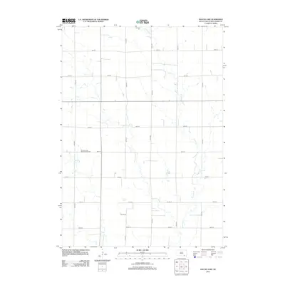
2012 Map of Haucks Lake
USGS Topo · Published 2012About this map
Emanuel Creek and its tributary, Little Emanuel Creek, meander across this Bon Homme County landscape, defining the rural character of the region. The map preserves the locations of several significant local landmarks, including the Emanuel Creek Baptisten Kirche Cem and Immanuel Cemetery, which offer valuable data for genealogical research in this part of South Dakota. The topography is dominated by the drainage patterns of these creeks as they flow southward toward the Missouri River valley, with Haucks Lake and its namesake Haucks Lane serving as a distinct geographic anchor in the southern portion of the quadrangle. A strict section-line road grid, including 410th Avenue and 300th Street, organizes the farmland and connects the scattered homesteads that comprise this agricultural community.
Find a feature on this map
20 named features on this map. Tap any name to fly to it.
Don’t see what you’re looking for? This feature index may not catch every label — zoom into the map to look around manually.
Map Details
Editions of this 2012 Haucks Lake Map
This is the sole edition of this map. No revisions or reprints were ever made.
Other maps of this area

1898 · Olivet
USGS Topo · 1:125,000

1955 · Sioux City
USGS Topo · 1:250,000

1955 · Sioux Falls
USGS Topo · 1:250,000

1955 · Mitchell
USGS Topo · 1:250,000

1955 · O'Neill
USGS Topo · 1:250,000

1958 · Sioux City
USGS Topo · 1:250,000

1958 · Sioux Falls
USGS Topo · 1:250,000

1959 · O'Neill
USGS Topo · 1:250,000

1959 · Sioux City
USGS Topo · 1:250,000

1959 · Mitchell
USGS Topo · 1:250,000
Featured Places
- Monroe Township, SD
- Avon Township, SD
- Emanuel Township, SD
- Dawson Hutterite Colony, SD
- Franklin Township, SD