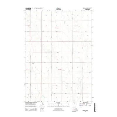
2015 Map of Haucks Lake
USGS Topo · Published 2015About this map
Turkey Valley defines the topography of this rural section of Bon Homme County, where the landscape is carved by the winding paths of Emanuel Cr and Little Emanuel Cr. The area is characterized by a high density of section-line roads, such as 295th St and 300th St, which frame the agricultural parcels and small water bodies like Haucks Lake. Cultural and genealogical history is preserved in the localized sacred sites that anchor the community, including the Emanuel Creek Baptisten Kirche Cem and Immanuel Cem. These landmarks, along with the precise Public Land Survey System boundaries like t96n r60w, reflect the systematic settlement and enduring heritage of this South Dakota prairie region.
Find a feature on this map
18 named features on this map. Tap any name to fly to it.
Don’t see what you’re looking for? This feature index may not catch every label — zoom into the map to look around manually.
Map Details
Editions of this 2015 Haucks Lake Map
This is the sole edition of this map. No revisions or reprints were ever made.
Other maps of this area

1898 · Olivet
USGS Topo · 1:125,000

1955 · Sioux City
USGS Topo · 1:250,000

1955 · Sioux Falls
USGS Topo · 1:250,000

1955 · Mitchell
USGS Topo · 1:250,000

1955 · O'Neill
USGS Topo · 1:250,000

1958 · Sioux City
USGS Topo · 1:250,000

1958 · Sioux Falls
USGS Topo · 1:250,000

1959 · O'Neill
USGS Topo · 1:250,000

1959 · Sioux City
USGS Topo · 1:250,000

1959 · Mitchell
USGS Topo · 1:250,000
Featured Places
- Monroe Township, SD
- Avon Township, SD
- Emanuel Township, SD
- Dawson Hutterite Colony, SD
- Franklin Township, SD