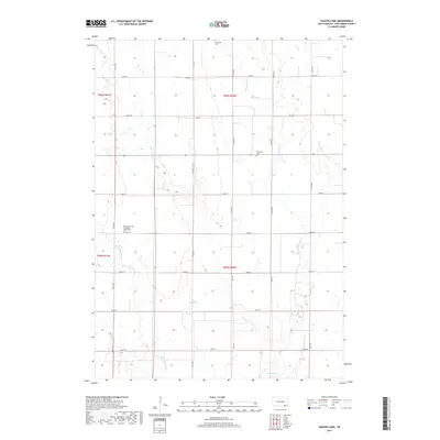
2017 Map of Haucks Lake
USGS Topo · Published 2017About this map
Haucks Lake sits at the center of this rural landscape in Monroe Township, surrounded by a grid of section lines and gravel roads such as 295th St and 412th Ave. The terrain is defined by the winding course of Emanuel Cr and Little Emanuel Cr, which carve gentle drainages across the Bon Homme County prairie. For the family historian, the map identifies several distinct burial sites including the Emanuel Creek Baptisten Kirche Cem, Immanuel Cem, and Wittmeier Cem. These sites, along with the scattered farmsteads, reveal a settlement pattern deeply rooted in the agricultural traditions of South Dakota's immigrant communities during the late twentieth century. The map provides an exacting look at the hydrology and land divisions that have structured this corner of the state for generations.
Find a feature on this map
23 named features on this map. Tap any name to fly to it.
Don’t see what you’re looking for? This feature index may not catch every label — zoom into the map to look around manually.
Map Details
Editions of this 2017 Haucks Lake Map
This is the sole edition of this map. No revisions or reprints were ever made.
Other maps of this area

1898 · Olivet
USGS Topo · 1:125,000

1955 · Sioux City
USGS Topo · 1:250,000

1955 · Sioux Falls
USGS Topo · 1:250,000

1955 · Mitchell
USGS Topo · 1:250,000

1955 · O'Neill
USGS Topo · 1:250,000

1958 · Sioux City
USGS Topo · 1:250,000

1958 · Sioux Falls
USGS Topo · 1:250,000

1959 · O'Neill
USGS Topo · 1:250,000

1959 · Sioux City
USGS Topo · 1:250,000

1959 · Mitchell
USGS Topo · 1:250,000
Featured Places
- Monroe Township, SD
- Avon Township, SD
- Emanuel Township, SD
- Dawson Hutterite Colony, SD
- Franklin Township, SD