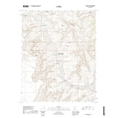
2018 Map of Havasupai Point
USGS Topo · Published 2018About this map
The Colorado River carves a deep path through Grand Canyon National Park, revealing the dramatic verticality of the Arizona landscape. This survey documents the complex erosional features that define the North and South Rims, from the towering heights of Havasupai Point and Point Sublime to the shadowed depths of the Granite Gorge. The map illustrates a network of named canyons and side streams, including Shinumo Cr and Turquoise Canyon, which feed into the river at turbulent points like Shinumo Rapids and Agate Rapids. Isolated topographic features such as Dox Castle, Castor Temple, and Fossil Mtn stand as prominent landmarks above the vast basins of the Shinumo Amphitheater and Monadnock Amphitheater. Access through this wilderness is marked by historic routes like the W Tonto and S Bass trails, which navigate the steep descents from the Shaler Plateau and Le Conte Plateau to the river's edge.
Find a feature on this map
57 named features on this map. Tap any name to fly to it.
Don’t see what you’re looking for? This feature index may not catch every label — zoom into the map to look around manually.
Map Details
Editions of this 2018 Havasupai Point Map
This is the sole edition of this map. No revisions or reprints were ever made.
Other maps of this area

1886 · Kaibab
USGS Topo · 1:250,000

1903 · Bright Angel
USGS Topo · 1:48,000

1906 · Bright Angel
USGS Topo · 1:48,000

1953 · Grand Canyon
USGS Topo · 1:250,000

1957 · Grand Canyon
USGS Topo · 1:250,000

1958 · Grand Canyon
USGS Topo · 1:250,000

1960 · Grand Canyon
USGS Topo · 1:250,000

1962 · Bright Angel
USGS Topo · 1:48,000

1962 · De Motte Park
USGS Topo · 1:62,500

1962 · Havasupai Point
USGS Topo · 1:62,500