
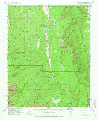
1962 Map of De Motte Park
USGS Topo · Published 1964About this map
Kaibab National Forest and the northern reaches of Grand Canyon National Park meet in this early 1960s study of the high plateau country. The transition from the dense forest of De Motte Park to the dramatic rim topography is documented through a network of fire lookouts and seasonal landmarks, including the Kanabownits Lookout Tower and Dry Park Lookout. Settlement is sparse, limited to the Kaibab Lodge and scattered water sources like Mason Well and Sourdough Well, which served the region's ranching and forestry needs.
Find a feature on this map
94 named features on this map. Tap any name to fly to it.
Don’t see what you’re looking for? This feature index may not catch every label — zoom into the map to look around manually.
Map Details
Editions of this 1962 De Motte Park Map
2 editions found
Other maps of this area

1886 · Echo Cliffs
USGS Topo · 1:250,000

1886 · Kaibab
USGS Topo · 1:250,000

1891 · Echo Cliffs
USGS Topo · 1:250,000

1903 · Bright Angel
USGS Topo · 1:48,000

1906 · Bright Angel
USGS Topo · 1:48,000

1907 · Vishnu
USGS Topo · 1:48,000

1936 · Jacobs Lake
USGS Topo · 1:48,000

1940 · Jacob Lake
USGS Topo · 1:62,500

1953 · Jacobs Lake
USGS Topo · 1:62,500

1953 · Grand Canyon
USGS Topo · 1:250,000