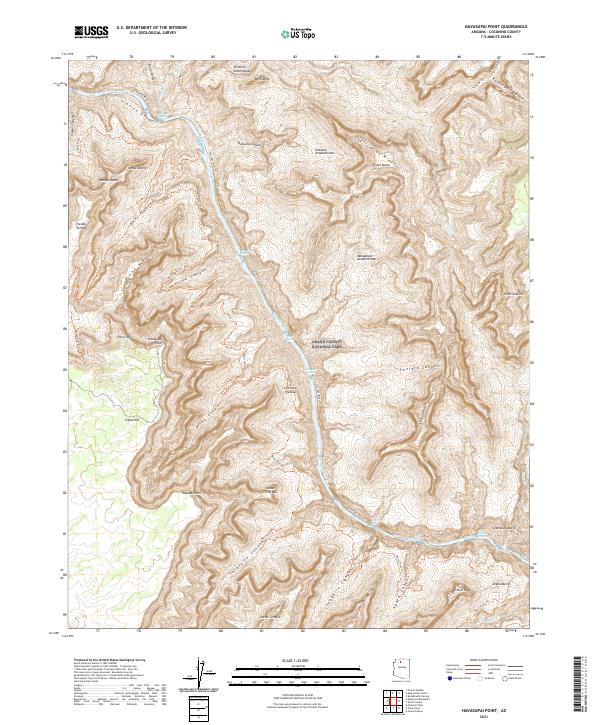
2021 Map of Havasupai Point
USGS Topo · Published 2021About this map
Grand Canyon National Park terrain dominates this detailed 2021 survey, centered on the dramatic descent from the South Rim into the Inner Gorge. The Colorado River carves through the landscape, marked by significant navigational points including Shinumo Rapids, Bass Rapids, and Ruby Rapids. The map provides a high-resolution look at the intricate trail systems used by generations of hikers and explorers, specifically the South Bass Trl, North Bass Trl, and the West Tonto Trl. High-elevation landmarks such as Havasupai Point, Fossil Mtn, and the wide expanses of the Shaler Plateau and LeConte Plateau are clearly delineated against the steep side canyons. Named formations like Dox Castle and Castor Temple highlight the unique geological naming conventions used throughout this section of the canyon.
Find a feature on this map
58 named features on this map. Tap any name to fly to it.
Don’t see what you’re looking for? This feature index may not catch every label — zoom into the map to look around manually.
Map Details
Editions of this 2021 Havasupai Point Map
This is the sole edition of this map. No revisions or reprints were ever made.
Other maps of this area

1886 · Kaibab
USGS Topo · 1:250,000

1903 · Bright Angel
USGS Topo · 1:48,000

1906 · Bright Angel
USGS Topo · 1:48,000

1953 · Grand Canyon
USGS Topo · 1:250,000

1957 · Grand Canyon
USGS Topo · 1:250,000

1958 · Grand Canyon
USGS Topo · 1:250,000

1960 · Grand Canyon
USGS Topo · 1:250,000

1962 · Bright Angel
USGS Topo · 1:48,000

1962 · De Motte Park
USGS Topo · 1:62,500

1962 · Havasupai Point
USGS Topo · 1:62,500