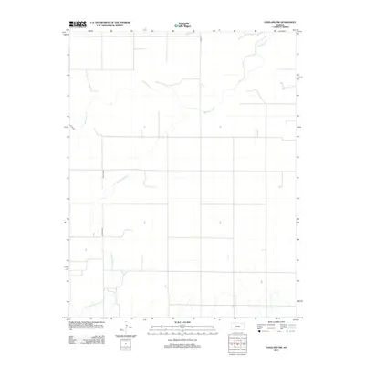
2012 Map of Haviland NW
USGS Topo · Published 2012About this map
Rattlesnake Creek and its tributary, the E Fork Rattlesnake Creek, define the sparse hydrology of this Kiowa County landscape. This 2012 survey illustrates the grid-based land management of rural Kansas, where the natural, meandering paths of these watercourses contrast sharply with the rigid section lines that divide the plains. The terrain is primarily shaped by these seasonal drainages, which provide the only significant relief in an otherwise flat agricultural region. Local travel is facilitated by a network of rural routes, including Co Rd 45 and Kc Ave 35, which follow the cardinal directions of the original public land surveys. For researchers, the map provides a precise record of the physical geography and road infrastructure in the early 21st century.
Find a feature on this map
5 named features on this map. Tap any name to fly to it.
Don’t see what you’re looking for? This feature index may not catch every label — zoom into the map to look around manually.
Map Details
Editions of this 2012 Haviland NW Map
This is the sole edition of this map. No revisions or reprints were ever made.
Other maps of this area

1889 · Kinsley
USGS Topo · 1:125,000

1892 · Kinsley
USGS Topo · 1:125,000

1894 · Kinsley
USGS Topo · 1:125,000

1955 · Pratt
USGS Topo · 1:250,000

1959 · Pratt
USGS Topo · 1:250,000

1968 · Haviland NW
USGS Topo · 1:24,000

1968 · Haviland
USGS Topo · 1:24,000

1968 · Haviland NE
USGS Topo · 1:24,000

1968 · Brenham
USGS Topo · 1:24,000
1969 · Greensburg
USGS Topo · 1:24,000