
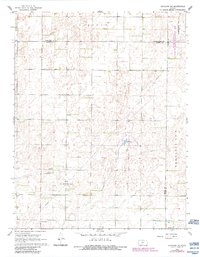
1968 Map of Haviland NE
USGS Topo · Published 1970About this map
The boundary lines of Wellsford, Banner, and McClellan intersect in this prairie landscape during the late 1960s. This portion of the High Plains is characterized by subtle depressions and ephemeral water features, most notably Lost Lake. The land use is a mix of agricultural plots and energy extraction, evidenced by a network of pipelines and the established Fruit Oil and Gas Field. For researchers tracing family histories in Kiowa and Pratt counties, the map serves as a detailed guide to local landmarks, including Providence Cem and Wellsford Cem. A lonely Jeep Trail provides one of the few passages through the more irregular terrain, while scattered Gas Wells underscore the industrial shift occurring alongside traditional farming practices.
Find a feature on this map
19 named features on this map. Tap any name to fly to it.
Don’t see what you’re looking for? This feature index may not catch every label — zoom into the map to look around manually.
Map Details
Editions of this 1968 Haviland NE Map
2 editions found
Other maps of this area

1889 · Kinsley
USGS Topo · 1:125,000

1892 · Kinsley
USGS Topo · 1:125,000

1892 · Pratt
USGS Topo · 1:125,000

1894 · Kinsley
USGS Topo · 1:125,000

1894 · Pratt
USGS Topo · 1:125,000

1955 · Pratt
USGS Topo · 1:250,000

1959 · Pratt
USGS Topo · 1:250,000

1968 · Cullison
USGS Topo · 1:24,000

1968 · Haviland NW
USGS Topo · 1:24,000

1968 · Haviland
USGS Topo · 1:24,000