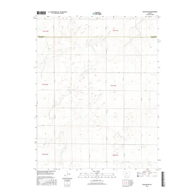
2015 Map of Haviland NW
USGS Topo · Published 2015About this map
The prairie landscape of south-central Kansas is defined by the winding course of Rattlesnake Cr as it traverses the county line between Edwards Co and Kiowa Co. This modern topographic study reveals a rural interior primarily structured by a grid of named section roads such as 190th Ave and Co Rd 45. The hydrology of the region is punctuated by the E Fork Rattlesnake Cr, which provides the primary drainage for the surrounding township lands. While no major urban settlements are present within these boundaries, the intricate network of local connectors like KC D St and KC G St indicates the enduring importance of road access for the agricultural operations and land management that sustain the local economy.
Find a feature on this map
26 named features on this map. Tap any name to fly to it.
Don’t see what you’re looking for? This feature index may not catch every label — zoom into the map to look around manually.
Map Details
Editions of this 2015 Haviland NW Map
This is the sole edition of this map. No revisions or reprints were ever made.
Other maps of this area

1889 · Kinsley
USGS Topo · 1:125,000

1892 · Kinsley
USGS Topo · 1:125,000

1894 · Kinsley
USGS Topo · 1:125,000

1955 · Pratt
USGS Topo · 1:250,000

1959 · Pratt
USGS Topo · 1:250,000

1968 · Haviland NW
USGS Topo · 1:24,000

1968 · Haviland
USGS Topo · 1:24,000

1968 · Haviland NE
USGS Topo · 1:24,000

1968 · Brenham
USGS Topo · 1:24,000
1969 · Greensburg
USGS Topo · 1:24,000