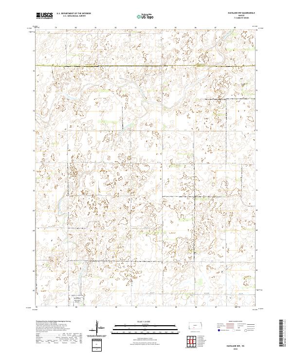
2022 Map of Haviland NW
USGS Topo · Published 2022About this map
The boundary between Edwards Co and Kiowa Co cuts across the northern reaches of this High Plains landscape, where the drainage of Rattlesnake Cr and its E Fork Rattlesnake Cr meander through a series of prairie depressions. The land is defined by a rigorous section-line road network, including routes like KC 37 Ave and Co Rd 45, which organize the agricultural terrain. In the southern portion of the quadrangle, the Greensburg Municipal Airport serves as a modern waypoint, situated near the intersection of KC H Ave and other local connectors. This 2022 survey illustrates the enduring township-and-range structure of south-central Kansas, detailing the intersection of rural infrastructure and the subtle hydrology of the Rattlesnake Creek basin.
Find a feature on this map
29 named features on this map. Tap any name to fly to it.
Don’t see what you’re looking for? This feature index may not catch every label — zoom into the map to look around manually.
Map Details
Editions of this 2022 Haviland NW Map
This is the sole edition of this map. No revisions or reprints were ever made.
Other maps of this area

1889 · Kinsley
USGS Topo · 1:125,000

1892 · Kinsley
USGS Topo · 1:125,000

1894 · Kinsley
USGS Topo · 1:125,000

1955 · Pratt
USGS Topo · 1:250,000

1959 · Pratt
USGS Topo · 1:250,000

1968 · Haviland NW
USGS Topo · 1:24,000

1968 · Haviland
USGS Topo · 1:24,000

1968 · Haviland NE
USGS Topo · 1:24,000

1968 · Brenham
USGS Topo · 1:24,000
1969 · Greensburg
USGS Topo · 1:24,000