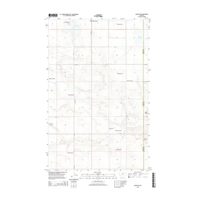
2014 Map of Havre NE
USGS Topo · Published 2014About this map
East End Colony sits at the northern edge of this North Central Montana landscape, marking a distinct pocket of communal settlement in the high plains. The topography is defined by the gradual descent into a series of deep drainage features, including Redrock Coulee and McLaren Coulee, which carve through the dry tablelands. This 2014 survey documents the Hill Co Blaine Co boundary as it runs through a sparsely populated area characterized by ephemeral water bodies and large-scale land divisions. The presence of Grassy Lake and the aptly named Dry Lake highlights the precarious nature of water resources in this region. Local transit is managed through a network of section-line roads like Shepherd Rd and Rd 126 N, which facilitate the movement of agricultural goods across the wide-open township boundaries.
Find a feature on this map
20 named features on this map. Tap any name to fly to it.
Don’t see what you’re looking for? This feature index may not catch every label — zoom into the map to look around manually.
Map Details
Editions of this 2014 Havre NE Map
This is the sole edition of this map. No revisions or reprints were ever made.
Other maps of this area

1904 · Yantic
USGS Topo · 1:62,500

1904 · Havre
USGS Topo · 1:62,500

1912 · Zurich
USGS Topo · 1:125,000

1912 · Thibedeau Lake
USGS Topo · 1:125,000

1953 · Havre
USGS Topo · 1:250,000

1957 · Havre
USGS Topo · 1:250,000

1958 · Havre
USGS Topo · 1:250,000

1964 · Havre NW
USGS Topo · 1:24,000

1964 · Havre SE
USGS Topo · 1:24,000

1964 · Havre
USGS Topo · 1:24,000