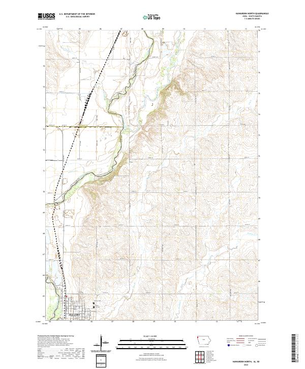
2022 Map of Hawarden North
USGS Topo · Published 2022About this map
Hawarden anchors the southwestern corner of this survey, where the town's grid meets the agricultural reaches of Sioux County. Two primary burial grounds, Grace Hill Cem and Calvary Cem, are established on the northern edge of the settlement, providing valuable reference points for local genealogy. The landscape is defined by the winding course of the Big Sioux River, which serves as the state boundary between Iowa and South Dakota. This riparian corridor is paralleled by the Jay Heath Canoe & Kayak Trl, tracing the river's bends through Lincoln and Union counties. The confluence of the Rock River and various tributaries like Sixmile Cr and Dry Cr creates a complex drainage system across the rural township, illustrating the relationship between the regional hydrology and the rectilinear road network of the prairie.
Find a feature on this map
50 named features on this map. Tap any name to fly to it.
Don’t see what you’re looking for? This feature index may not catch every label — zoom into the map to look around manually.
Map Details
Editions of this 2022 Hawarden North Map
This is the sole edition of this map. No revisions or reprints were ever made.
Other maps of this area

1897 · Canton
USGS Topo · 1:125,000

1898 · Elk Point
USGS Topo · 1:125,000

1900 · Canton
USGS Topo · 1:125,000

1901 · Elk Point
USGS Topo · 1:125,000

1907 · Elk Point
USGS Topo · 1:125,000

1955 · Sioux City
USGS Topo · 1:250,000

1955 · Sioux Falls
USGS Topo · 1:250,000

1958 · Sioux City
USGS Topo · 1:250,000

1958 · Sioux Falls
USGS Topo · 1:250,000

1959 · Sioux City
USGS Topo · 1:250,000