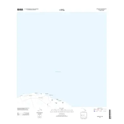
2013 Map of Hawi OE N
USGS Topo · Published 2013About this map
Upolu Point marks the northernmost tip of the Island of Hawai'i, where the land meets the vast expanse of the Pacific Ocean. This coastal survey documents a specialized landscape defined by the Upolu Airport and the residential cluster at Hoea Camp. The terrain is deeply incised by a series of drainages, including Lipoa Gulch, Waipiele Gulch, Kumakua Gulch, and Kapua Gulch, which dictate the local topography as they descend toward the shoreline. Access to this windward coast is provided by Ulolu Point Rd and Hoea Rd, connecting the airfield and local settlements to the broader island infrastructure. Along the jagged coastline, features like Kepuhi Point and Alanahihi Point frame small coastal pockets such as Pahoa Beach.
Find a feature on this map
14 named features on this map. Tap any name to fly to it.
Don’t see what you’re looking for? This feature index may not catch every label — zoom into the map to look around manually.
Map Details
Editions of this 2013 Hawi OE N Map
This is the sole edition of this map. No revisions or reprints were ever made.
Other maps of this area

1913 · Kohala
USGS Topo · 1:62,500

1916 · Kohala
USGS Topo · 1:62,500

1916 · Waipio
USGS Topo · 1:62,500

1954 · Hawaii North
USGS Topo · 1:250,000
1957 · Honokane
USGS Topo · 1:24,000
1957 · Mahukona
USGS Topo · 1:24,000
1957 · Hawi
USGS Topo · 1:24,000

1959 · Hawaii North
USGS Topo · 1:250,000

1961 · Hawaii North
USGS Topo · 1:250,000

1975 · Hawaii
USGS Topo · 1:250,000