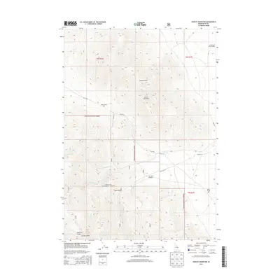
2013 Map of Hawley Mountain
USGS Topo · Published 2013About this map
The Lost River Range and Hawley Mountains dominate this 2013 topographic study of Butte County, Idaho. Much of the land is managed as part of the Challis National Forest, defined by significant elevation changes between high peaks and deep drainage basins. The eastern edge of the quadrangle opens into the Little Lost River Valley, where the River Rd provides access to the Deer Creek Bar near the mountains' base. Historical movement through this high-altitude landscape is traced via Deer Creek Pass and several Forest Service routes including NFD 278 Rd and the NFD 527 Trl. Water resources are concentrated in the intricate drainage systems of Hawley Canyon, Van Dorn Canyon, and Black Tail Canyon, which feed the forks of Deer Creek.
Find a feature on this map
21 named features on this map. Tap any name to fly to it.
Don’t see what you’re looking for? This feature index may not catch every label — zoom into the map to look around manually.
Map Details
Editions of this 2013 Hawley Mountain Map
This is the sole edition of this map. No revisions or reprints were ever made.
Other maps of this area

1955 · Dubois
USGS Topo · 1:250,000

1955 · Idaho Falls
USGS Topo · 1:250,000

1957 · Diamond Peak
USGS Topo · 1:62,500

1957 · Hawley Mountain
USGS Topo · 1:62,500

1958 · Dubois
USGS Topo · 1:250,000

1958 · Idaho Falls
USGS Topo · 1:250,000

1969 · Howe NW
USGS Topo · 1:24,000

1969 · Sunset Peak
USGS Topo · 1:24,000
1969 · Methodist Creek
USGS Topo · 1:24,000
1987 · Mulkey Bar
USGS Topo · 1:24,000