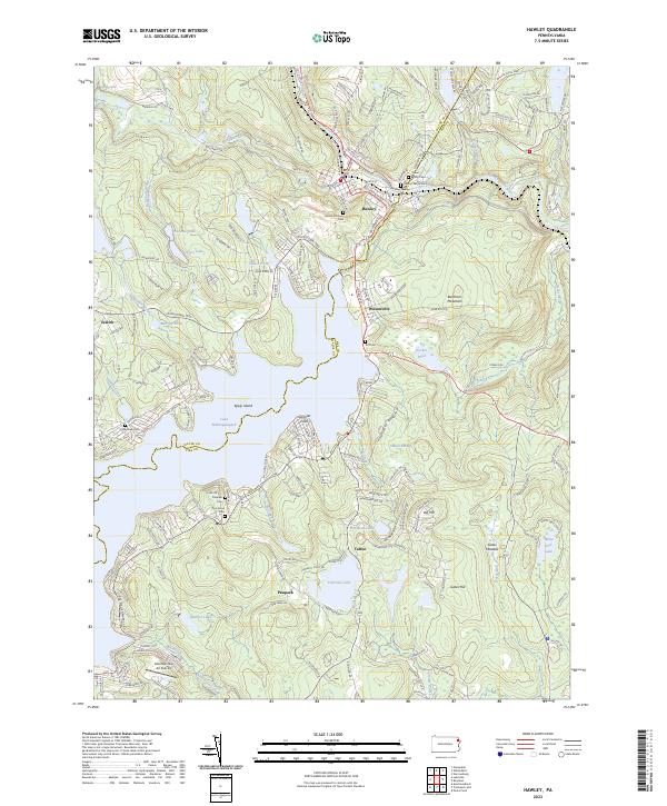
2023 Map of Hawley
USGS Topo · Published 2023About this map
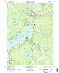
The Lackawaxen River and the expansive Lake Wallenpaupack dominate this section of the Poconos, where the borough of Hawley serves as a primary local hub. The map reveals a landscape defined by its transition from industrial riverfront to seasonal recreation, with the massive shoreline of Lake Wallenpaupack featuring landmarks like Epply Island and Spinnler Point. For those researching family history, numerous burial grounds are documented throughout the townships, including Walnut Grove Cem, Hawley Cem, and the Queen of Peace Cem.
Find a feature on this map
73 named features on this map. Tap any name to fly to it.
Don’t see what you’re looking for? This feature index may not catch every label — zoom into the map to look around manually.
Map Details
Editions of this 2023 Hawley Map
This is the sole edition of this map. No revisions or reprints were ever made.
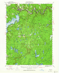
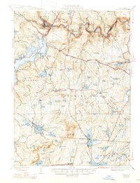
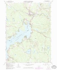
Historical Maps of Palmyra Township Through Time
6 maps found

Featured Locations
- Blooming Grove Township, PA
- Lackawaxen Township, PA
- Palmyra Township, PA
- Paupack Township, PA
- Hawley, PA