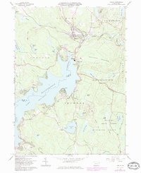
1966 Map of Hawley
USGS Topo · Published 1983About this map
The massive expanse of Lake Wallenpaupack dominates this landscape on the Wayne and Pike County border, reflecting a region deeply shaped by mid-century recreation and utility. At the northern tip, the borough of Hawley sits at the confluence of the Lackawaxen River and Wallenpaupack Creek, while smaller communities like Wilsonville, Tafton, and Paupack dot the surrounding hills. This survey, updated with 1981 data, highlights a developed lakefront featuring Caffrey Campground and the Wallenpaupack Area High Sch. Beyond the water, the terrain is characterized by heavy woodland, including State Game Lands No 183 and the Delaware State Forest. Local history is anchored by the Paupack Cem, Pine Grove Cem, and St Veronicas Ch, while the Stourbridge Trail follows the river valley through the center of Hawley.
Find a feature on this map
63 named features on this map. Tap any name to fly to it.
Don’t see what you’re looking for? This feature index may not catch every label — zoom into the map to look around manually.
Map Details
Editions of this 1966 Hawley Map
3 editions found
Other maps of this area

1892 · Honesdale
USGS Topo · 1:62,500

1920 · Damascus
USGS Topo · 1:62,500

1923 · Damascus
USGS Topo · 1:62,500

1928 · Ariel
USGS Topo · 1:62,500

1932 · Ariel
USGS Topo · 1:62,500

1935 · Hawley
USGS Topo · 1:62,500

1938 · Hawley
USGS Topo · 1:62,500

1943 · Honesdale
USGS Topo · 1:125,000

1944 · Damascus
USGS Topo · 1:62,500

1946 · Honesdale
USGS Topo · 1:24,000