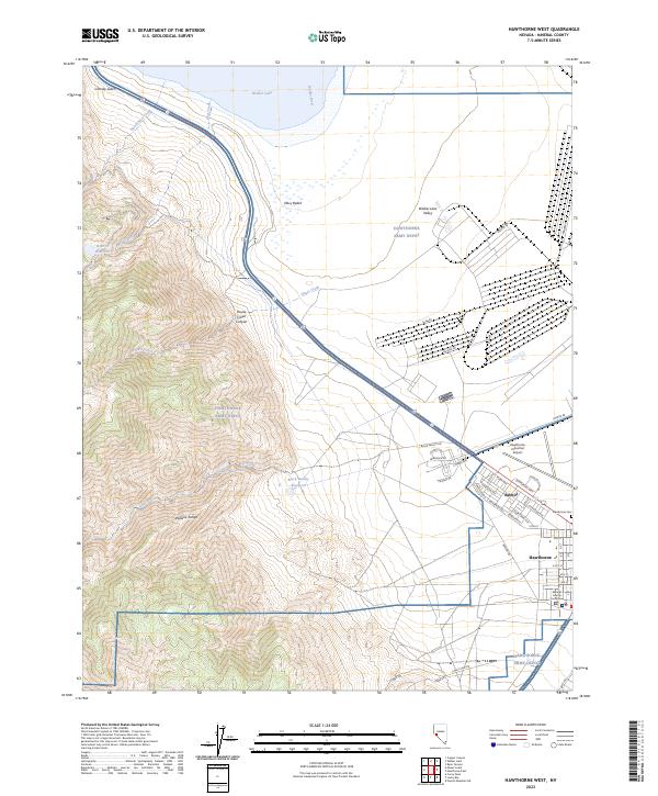
2023 Map of Hawthorne West
USGS Topo · Published 2023About this map
Hawthorne and the neighboring military community of Babbitt sit at the southern edge of Walker Lake, anchored by the massive footprint of the Hawthorne Army Depot. The map reveals a highly structured landscape where the grid of town streets meets the specialized layout of the depot, including numerous bunkers and industrial access roads like Salvage RD and Lake RD. To the west, the steep slopes of the Wassuk Range rise sharply, dissected by drainages such as House Creek Canyon and Chaney Gulch. This modern survey illustrates the enduring relationship between the community and the military installation, while also noting local civic landmarks like the Mineral County Courthouse and the Hawthorne Industrial Airport. Notable water features include Cat Cr Reservoir and the Walker River delta, providing a detailed look at the hydrology of the Walker Lake Valley.
Find a feature on this map
64 named features on this map. Tap any name to fly to it.
Don’t see what you’re looking for? This feature index may not catch every label — zoom into the map to look around manually.
Map Details
Editions of this 2023 Hawthorne West Map
This is the sole edition of this map. No revisions or reprints were ever made.
Other maps of this area

1909 · Hawthorne
USGS Topo · 1:250,000

1911 · Hawthorne
USGS Topo · 1:250,000

1915 · Hawthorne
USGS Topo · 1:250,000

1948 · Walker Lake
USGS Topo · 1:250,000

1955 · Powell Mtn
USGS Topo · 1:62,500

1955 · Hawthorne
USGS Topo · 1:62,500

1956 · Mt. Grant
USGS Topo · 1:62,500

1956 · Aurora
USGS Topo · 1:62,500

1957 · Walker Lake
USGS Topo · 1:250,000

1962 · Walker Lake
USGS Topo · 1:250,000