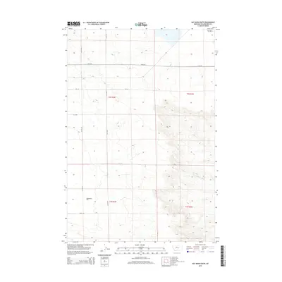
2014 Map of Hay Basin South
USGS Topo · Published 2014About this map
Hay Basin and the wide expanse of Comanche Flat dominate this section of Yellowstone County as it appeared in the early 21st century. The landscape is defined by a sparse but systematic grid of rural roads, including Van Sky Rd, Oswald Rd, and the east-west corridor of 21 Mile Rd. These routes follow the section lines of the Public Land Survey System, illustrating how land division has shaped the modern Montana prairie. In the southeastern reaches, the terrain descends toward the S Fork Crooked Cr, where the contour lines tighten, indicating the breaks and coulees that drain the basin. This survey provides a clear look at the large-scale agricultural and ranching parcels that characterize this region north of the Yellowstone River, where place names like Birkley Rd and Allen Rd often reflect long-standing local families and property boundaries.
Find a feature on this map
15 named features on this map. Tap any name to fly to it.
Don’t see what you’re looking for? This feature index may not catch every label — zoom into the map to look around manually.
Map Details
Editions of this 2014 Hay Basin South Map
This is the sole edition of this map. No revisions or reprints were ever made.
Other maps of this area

1954 · Billings
USGS Topo · 1:250,000

1954 · Roundup
USGS Topo · 1:250,000

1956 · Comanche
USGS Topo · 1:24,000

1956 · Acton
USGS Topo · 1:24,000

1956 · Hickson Ranch
USGS Topo · 1:24,000

1957 · Billings
USGS Topo · 1:250,000

1958 · Billings
USGS Topo · 1:250,000

1958 · Roundup
USGS Topo · 1:250,000

1979 · Roundup
USGS Topo · 1:100,000

1979 · Hay Basin NE
USGS Topo · 1:24,000