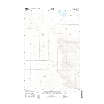
2017 Map of Hay Basin South
USGS Topo · Published 2017About this map
Comanche Flat and the low-lying Hay Basin define this section of Yellowstone County, where the topography transitions from the level plains to more complex drainages. The landscape is marked by the presence of ephemeral water systems like the S Fork Crooked Cr, which carves through the eastern portion of the quadrangle. The 2017 survey reveals a highly organized grid of rural roads, including Van Sky Rd, Oswald Rd, and Birkley Rd, reflecting the large-scale agricultural and ranching operations of the region. Distinctive local names for trails or roads such as Redline, Tumbleweed, and Rollercoaster appear in the rugged breaks near the creek, suggesting the practical nomenclature used by those working the land.
Find a feature on this map
23 named features on this map. Tap any name to fly to it.
Don’t see what you’re looking for? This feature index may not catch every label — zoom into the map to look around manually.
Map Details
Editions of this 2017 Hay Basin South Map
This is the sole edition of this map. No revisions or reprints were ever made.
Other maps of this area

1954 · Billings
USGS Topo · 1:250,000

1954 · Roundup
USGS Topo · 1:250,000

1956 · Comanche
USGS Topo · 1:24,000

1956 · Acton
USGS Topo · 1:24,000

1956 · Hickson Ranch
USGS Topo · 1:24,000

1957 · Billings
USGS Topo · 1:250,000

1958 · Billings
USGS Topo · 1:250,000

1958 · Roundup
USGS Topo · 1:250,000

1979 · Roundup
USGS Topo · 1:100,000

1979 · Hay Basin NE
USGS Topo · 1:24,000