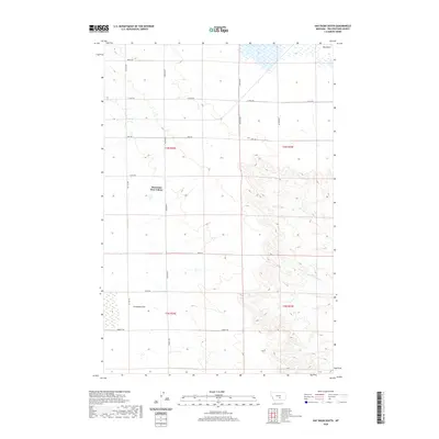
2020 Map of Hay Basin South
USGS Topo · Published 2020About this map
Mountain View Colony sits at the heart of this landscape in Yellowstone County, illustrating the continued presence of Hutterite agricultural settlements in the Montana plains. The terrain is defined by the broad expanse of Hay Basin to the north and the low-lying Comanche Flat to the south, separated by a series of defined ridges and coulees that feed the S Fork Crooked Cr. A geometric grid of section lines and gravel roads, including Van Sky Rd, Oswald Rd, and 21 Mile Rd, dictates the local movement and land division, showing a rural economy still deeply tied to its original survey boundaries. This topography captures a specific moment in 2020, documenting the modern infrastructure of a region characterized by its wide-open ranching and farming tracts.
Find a feature on this map
20 named features on this map. Tap any name to fly to it.
Don’t see what you’re looking for? This feature index may not catch every label — zoom into the map to look around manually.
Map Details
Editions of this 2020 Hay Basin South Map
This is the sole edition of this map. No revisions or reprints were ever made.
Other maps of this area

1954 · Billings
USGS Topo · 1:250,000

1954 · Roundup
USGS Topo · 1:250,000

1956 · Comanche
USGS Topo · 1:24,000

1956 · Acton
USGS Topo · 1:24,000

1956 · Hickson Ranch
USGS Topo · 1:24,000

1957 · Billings
USGS Topo · 1:250,000

1958 · Billings
USGS Topo · 1:250,000

1958 · Roundup
USGS Topo · 1:250,000

1979 · Roundup
USGS Topo · 1:100,000

1979 · Hay Basin NE
USGS Topo · 1:24,000