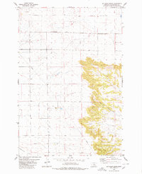
1980 Map of Hay Basin South
USGS Topo · Published 1980About this map
Fortney Ranch and the small settlement of Conover anchor this high plains landscape in Yellowstone County during the early 1980s. The map captures a transitional rangeland defined by the broad expanse of Comanche Flat to the south and the dramatic, rising terrain of Hay Basin to the north. A critical Pipeline cuts diagonally across the western sections, reflecting the region's industrial infrastructure alongside more traditional landmarks like the Twentyone Mile Road.
Find a feature on this map
11 named features on this map. Tap any name to fly to it.
Don’t see what you’re looking for? This feature index may not catch every label — zoom into the map to look around manually.
Map Details
Editions of this 1980 Hay Basin South Map
This is the sole edition of this map. No revisions or reprints were ever made.
Other maps of this area

1954 · Billings
USGS Topo · 1:250,000

1954 · Roundup
USGS Topo · 1:250,000

1956 · Comanche
USGS Topo · 1:24,000

1956 · Acton
USGS Topo · 1:24,000

1956 · Hickson Ranch
USGS Topo · 1:24,000

1957 · Billings
USGS Topo · 1:250,000

1958 · Billings
USGS Topo · 1:250,000

1958 · Roundup
USGS Topo · 1:250,000

1979 · Roundup
USGS Topo · 1:100,000

1979 · Hay Basin NE
USGS Topo · 1:24,000