
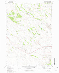
1980 Map of Hay Lake
USGS Topo · Published 1980About this map
Egli Ridge and the high terrain of Sheep Mountain dominate this corner of Harney County, characterized by a complex network of water management features essential for high-desert ranching. Surveyed in the mid-1970s, the landscape reveals the survival of early settler footprints through labels like the Old Egli Place and the Harry Arnold Ranch. These homesteads are supported by a wide array of catchment systems, including the Egli Reservoir, Egli Waterhole, and Spring Canyon Reservoir. The northeastern portion of the map includes a section of the Squaw Butte Experiment Station, indicating the region's importance for agricultural research. Geologic and natural curiosities are also present, such as the distinctive Hole in Ground and various seasonal water bodies like Rimrock Lake and Ryegrass Lake.
Find a feature on this map
26 named features on this map. Tap any name to fly to it.
Don’t see what you’re looking for? This feature index may not catch every label — zoom into the map to look around manually.
Map Details
Editions of this 1980 Hay Lake Map
This is the sole edition of this map. No revisions or reprints were ever made.
Other maps of this area

1955 · Burns
USGS Topo · 1:250,000

1958 · Burns
USGS Topo · 1:250,000

1959 · Burns
USGS Topo · 1:250,000

1980 · Squaw Butte
USGS Topo · 1:24,000

1980 · Wagontire Mtn West
USGS Topo · 1:24,000

1980 · Round Top Butte
USGS Topo · 1:24,000

1980 · Alec Butte
USGS Topo · 1:24,000

1980 · Wagontire Mtn East
USGS Topo · 1:24,000

1981 · Hat Butte
USGS Topo · 1:24,000
1981 · Potato Hills
USGS Topo · 1:24,000