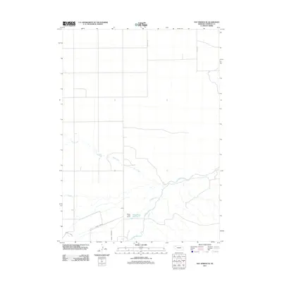
2011 Map of Hay Springs SE
USGS Topo · Published 2011About this map
Niobrara River frontage and the intricate irrigation infrastructure of Sheridan County define this high-plains landscape. The map centers on the Mirage Flats Reservoir 3 and the associated Mirage Flats Dam 3, highlighting the critical role of water management in this agricultural region. The system is further detailed through a network of canals and man-made waterways including the Peters Lateral, Sturgeon Lateral, and the Sturgeon Drain. Natural drainage is represented by the winding course of Spring Creek as it approaches the river valley. The rectangular road grid, typical of the rural Midwest, is anchored by local thoroughfares such as Church Rd and Strot Heide Rd, providing a clear view of the area's land division and rural layout during this period.
Find a feature on this map
9 named features on this map. Tap any name to fly to it.
Don’t see what you’re looking for? This feature index may not catch every label — zoom into the map to look around manually.
Map Details
Editions of this 2011 Hay Springs SE Map
This is the sole edition of this map. No revisions or reprints were ever made.
Other maps of this area

1948 · Twin Lakes
USGS Topo · 1:62,500

1950 · Twin Lakes
USGS Topo · 1:62,500

1950 · Skunk Lake
USGS Topo · 1:62,500

1955 · Alliance
USGS Topo · 1:250,000

1957 · Alliance
USGS Topo · 1:250,000

1958 · Alliance
USGS Topo · 1:250,000

1960 · Hay Springs SW
USGS Topo · 1:24,000

1960 · Hay Springs SE
USGS Topo · 1:24,000

1966 · Rushville
USGS Topo · 1:24,000

1966 · Rushville SW
USGS Topo · 1:24,000