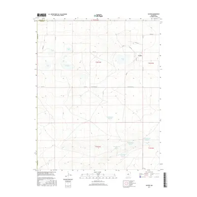
2017 Map of Hayden
USGS Topo · Published 2017About this map
Hayden serves as the central point of reference in this sparsely settled corner of Northeast New Mexico, where the landscape is defined by its water management and grazing potential. The high plains terrain is dotted with several prominent water bodies, including Morris Lake, Shields Lake, and the larger Lowry Lake. A sophisticated system of private water storage is evident in the series of numbered basins named for a local landowner, such as the Claude Hutcherson Number One Reservoir and Claude Hutcherson Number Five Reservoir along the drainage of Monia Cr. This network of reservoirs and springs, including Antelope Spring, reveals the critical role of water infrastructure in sustaining life and industry in the arid ranchlands of the Union County and Harding County border region.
Find a feature on this map
33 named features on this map. Tap any name to fly to it.
Don’t see what you’re looking for? This feature index may not catch every label — zoom into the map to look around manually.
Map Details
Editions of this 2017 Hayden Map
This is the sole edition of this map. No revisions or reprints were ever made.
Other maps of this area

1954 · Tucumcari
USGS Topo · 1:250,000

1954 · Dalhart
USGS Topo · 1:250,000

1958 · Tucumcari
USGS Topo · 1:250,000

1958 · Dalhart
USGS Topo · 1:250,000

1962 · Dalhart
USGS Topo · 1:250,000

1966 · Skull Mesa
USGS Topo · 1:24,000

1966 · Pedernal Creek
USGS Topo · 1:24,000

1966 · Rosebud
USGS Topo · 1:24,000

1966 · Ione
USGS Topo · 1:24,000

1966 · Hayden
USGS Topo · 1:24,000