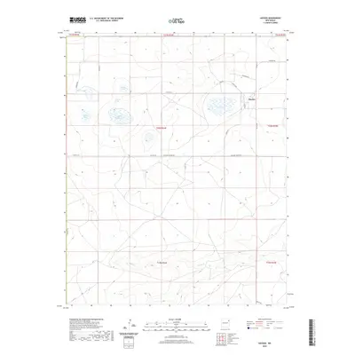
2020 Map of Hayden
USGS Topo · Published 2020About this map
Hayden serves as the focal point for this ranching and plains landscape in eastern New Mexico, where the high prairie is defined by a series of ephemeral water bodies and springs. Small depressions across the terrain create a network of seasonal catchments, including Morris Lake, Shields Lake, and Lowry Lake, which have historically provided vital water sources for local livestock. The drainage of Monia Cr cuts through the southern portion of the quadrangle, while the presence of Antelope Spring and the adjacent Antelope Spring Lake indicates the importance of groundwater in this arid environment. A grid of rural routes like Co Rd C118 and Antelope Springs Rd connects the scattered homesteads and pastures, illustrating the long-standing land divisions and survey patterns of the High Plains.
Find a feature on this map
28 named features on this map. Tap any name to fly to it.
Don’t see what you’re looking for? This feature index may not catch every label — zoom into the map to look around manually.
Map Details
Editions of this 2020 Hayden Map
This is the sole edition of this map. No revisions or reprints were ever made.
Other maps of this area

1954 · Tucumcari
USGS Topo · 1:250,000

1954 · Dalhart
USGS Topo · 1:250,000

1958 · Tucumcari
USGS Topo · 1:250,000

1958 · Dalhart
USGS Topo · 1:250,000

1962 · Dalhart
USGS Topo · 1:250,000

1966 · Skull Mesa
USGS Topo · 1:24,000

1966 · Pedernal Creek
USGS Topo · 1:24,000

1966 · Rosebud
USGS Topo · 1:24,000

1966 · Ione
USGS Topo · 1:24,000

1966 · Hayden
USGS Topo · 1:24,000