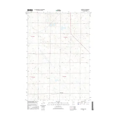
2016 Map of Haydenville
USGS Topo · Published 2016About this map
Haydenville stands as the primary namesake settlement in this corner of Lac qui Parle County, surrounded by the rectilinear geometry of a late-twentieth-century agricultural landscape. This portion of western Minnesota is defined by a rigorous grid of section lines and gravel roads, including north-south corridors like 151st Ave and 181st Ave, which separate sprawling fields and farmsteads. The small settlement at Haydenville remains the focus of the southern half of the quadrangle, connected by Co Hwy 55.
Find a feature on this map
29 named features on this map. Tap any name to fly to it.
Don’t see what you’re looking for? This feature index may not catch every label — zoom into the map to look around manually.
Map Details
Editions of this 2016 Haydenville Map
This is the sole edition of this map. No revisions or reprints were ever made.
Other maps of this area

1953 · Bellingham
USGS Topo · 1:62,500

1953 · Milbank
USGS Topo · 1:250,000

1953 · Watertown
USGS Topo · 1:250,000

1958 · Milbank
USGS Topo · 1:250,000

1958 · Watertown
USGS Topo · 1:250,000

1958 · Madison
USGS Topo · 1:24,000

1958 · Correll
USGS Topo · 1:24,000

1967 · Gary NW
USGS Topo · 1:24,000
1967 · Dawson NW
USGS Topo · 1:24,000
1967 · Mount Wickham
USGS Topo · 1:24,000