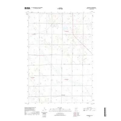
2019 Map of Haydenville
USGS Topo · Published 2019About this map
Haydenville stands as a central point in this Lac qui Parle County landscape, where the rectangular grid of the Public Land Survey System strictly governs the rural layout. The terrain is defined by a dense network of sectional roads such as 270th St and 161st Ave, which connect isolated homesteads and agricultural tracts. For those researching local lineages, the map preserves the locations of Zion Cem and Lokken Cem, both situated along these gravel and paved routes. The presence of numerous wetlands and small basins across the northern sections, particularly near Co Hwy 32, indicates a naturally glaciated prairie environment that has been carefully adapted for farming. This 2019 data reflects the enduring character of western Minnesota, where county highways like Co Hwy 13 and Co Hwy 24 serve as the primary arteries for a community deeply rooted in the land.
Find a feature on this map
29 named features on this map. Tap any name to fly to it.
Don’t see what you’re looking for? This feature index may not catch every label — zoom into the map to look around manually.
Map Details
Editions of this 2019 Haydenville Map
This is the sole edition of this map. No revisions or reprints were ever made.
Other maps of this area

1953 · Bellingham
USGS Topo · 1:62,500

1953 · Milbank
USGS Topo · 1:250,000

1953 · Watertown
USGS Topo · 1:250,000

1958 · Milbank
USGS Topo · 1:250,000

1958 · Watertown
USGS Topo · 1:250,000

1958 · Madison
USGS Topo · 1:24,000

1958 · Correll
USGS Topo · 1:24,000

1967 · Gary NW
USGS Topo · 1:24,000
1967 · Dawson NW
USGS Topo · 1:24,000
1967 · Mount Wickham
USGS Topo · 1:24,000