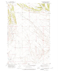
1972 Map of Haymaker Ranch
USGS Topo · Published 1976About this map
Haymaker Ranch stands as the primary namesake landmark in this corner of Wheatland County, situated along the winding drainage of Haymaker Creek. The landscape is defined by a network of seasonal watercourses and coulees, including the prominent Big Coulee and the uniquely named Mexican John Creek. Ranching operations are supported by a series of springs and wells scattered throughout the undulating terrain, connected by the arterial Haymaker Road. The drainages of Hopley Creek and the Middle Fork converge in the northern portion of the map, illustrating the vital water distribution system in this high plains environment during the early 1970s. This survey, based on 1971 aerial photography, documents the specific cattle-country infrastructure before late-century shifts in land use.
Find a feature on this map
11 named features on this map. Tap any name to fly to it.
Don’t see what you’re looking for? This feature index may not catch every label — zoom into the map to look around manually.
Map Details
Editions of this 1972 Haymaker Ranch Map
This is the sole edition of this map. No revisions or reprints were ever made.
Other maps of this area

1886 · Little Belt Mts.
USGS Topo · 1:250,000

1889 · Big Snowy Mountain
USGS Topo · 1:250,000

1893 · Big Snowy Mountain
USGS Topo · 1:250,000

1894 · Little Belt Mts.
USGS Topo · 1:250,000

1897 · Little Belt Mts.
USGS Topo · 1:250,000

1898 · Little Belt Mts.
USGS Topo · 1:250,000

1902 · Little Belt Mts.
USGS Topo · 1:250,000

1948 · White Sulphur Springs
USGS Topo · 1:250,000

1954 · Roundup
USGS Topo · 1:250,000

1958 · Roundup
USGS Topo · 1:250,000