
1902 Map of Little Belt Mts.
USGS Topo · Published 1902About this map
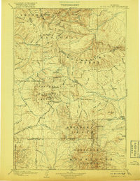
Little Belt Mountains topography dominates this reconnaissance survey, which documents central Montana as the nineteenth century closed. Mining interests are clearly evident through the presence of the Sapphire Mine and early camps like Neihart and Copperopolis. The area’s thermal resources are also noted at White Sulphur Springs, Brewer Springs, and Moss Agate Springs, marking the region’s importance for both industry and early tourism.
Find a feature on this map
126 named features on this map. Tap any name to fly to it.
Don’t see what you’re looking for? This feature index may not catch every label — zoom into the map to look around manually.
Map Details
Editions of this 1902 Little Belt Mts. Map
3 editions found
Other maps of this area

1886 · Great Falls
USGS Topo · 1:250,000

1886 · Fort Logan
USGS Topo · 1:250,000

1886 · Little Belt Mts.
USGS Topo · 1:250,000

1888 · Three Forks
USGS Topo · 1:250,000

1889 · Big Snowy Mountain
USGS Topo · 1:250,000

1890 · Fort Benton
USGS Topo · 1:250,000

1891 · Livingston
USGS Topo · 1:250,000

1891 · Big Timber
USGS Topo · 1:125,000

1892 · Fort Benton
USGS Topo · 1:250,000

1893 · Livingston
USGS Topo · 1:250,000