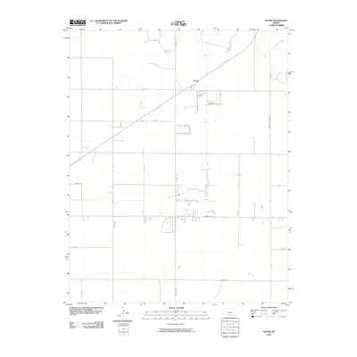
2010 Map of Hayne
USGS Topo · Published 2010About this map
Hayne remains a central landmark in this southwestern Kansas landscape, positioned along a major diagonal transportation corridor that cuts through the High Plains. The map reveals a highly structured agricultural grid, where long thoroughfares such as Arkalon Rd and Co Rd N organize the vast open spaces of Seward County. A cluster of smaller lanes, including Bennett Rd, Andrew Ln, and Telzey Ln, suggests a pocket of localized settlement and activity south of the main crossing. The infrastructure reflects a blend of rural residential life and industrial utility, evidenced by specialized routes like Booster Station Rd and Salvage Rd. This 2010 survey illustrates how the region has maintained its essential character while adapting to modern infrastructure needs, with the placement of roads like Bluebell Rd and E Pine St marking the subtle boundaries of the local community.
Find a feature on this map
22 named features on this map. Tap any name to fly to it.
Don’t see what you’re looking for? This feature index may not catch every label — zoom into the map to look around manually.
Map Details
Editions of this 2010 Hayne Map
This is the sole edition of this map. No revisions or reprints were ever made.
Other maps of this area

1954 · Perryton
USGS Topo · 1:250,000

1955 · Dodge City
USGS Topo · 1:250,000

1958 · Perryton
USGS Topo · 1:250,000

1958 · Dodge City
USGS Topo · 1:250,000

1959 · Dodge City
USGS Topo · 1:250,000

1968 · Liberal NE
USGS Topo · 1:24,000

1968 · Liberal NW
USGS Topo · 1:24,000

1971 · Liberal
USGS Topo · 1:24,000
1971 · Kismet
USGS Topo · 1:24,000

1971 · Kismet SW
USGS Topo · 1:24,000