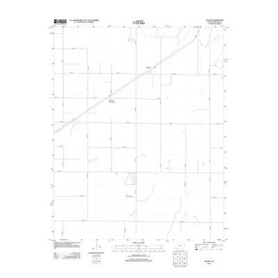
2012 Map of Hayne
USGS Topo · Published 2012About this map
Hayne anchors this section of Seward County, characterized by a highly organized section-line road network typical of the High Plains. The landscape is defined by its agricultural geometry, where long thoroughfares like Road N, Road M, and Road O facilitate movement across the prairie. A primary transportation artery cuts diagonally through the grid, connecting the small community of Hayne to the surrounding region. Outside the main settlement, the Western Star Recreational Vehicle Ranch serves as a distinct waypoint along Road 3. The transition between the northern and southern sections of the quadrangle is marked by subtle changes in the naming conventions of the grid, shifting to roads like S Road O and Bazarth Rd, reflecting local land use and historic property boundaries in this part of Kansas.
Find a feature on this map
24 named features on this map. Tap any name to fly to it.
Don’t see what you’re looking for? This feature index may not catch every label — zoom into the map to look around manually.
Map Details
Editions of this 2012 Hayne Map
This is the sole edition of this map. No revisions or reprints were ever made.
Other maps of this area

1954 · Perryton
USGS Topo · 1:250,000

1955 · Dodge City
USGS Topo · 1:250,000

1958 · Perryton
USGS Topo · 1:250,000

1958 · Dodge City
USGS Topo · 1:250,000

1959 · Dodge City
USGS Topo · 1:250,000

1968 · Liberal NE
USGS Topo · 1:24,000

1968 · Liberal NW
USGS Topo · 1:24,000

1971 · Liberal
USGS Topo · 1:24,000
1971 · Kismet
USGS Topo · 1:24,000

1971 · Kismet SW
USGS Topo · 1:24,000