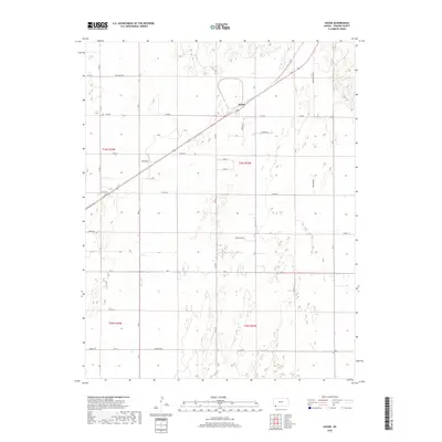
2018 Map of Hayne
USGS Topo · Published 2018About this map
Hayne sits at a geometric intersection of rail and road in the High Plains of Seward County. This modern survey illustrates the expansive, grid-aligned agricultural landscape of southwestern Kansas, where the township boundaries of t34s r32w and its neighbors define the orderly arrangement of the territory. The map reveals a network of named county roads such as Five Mile Rd and Warden Rd that provide the skeleton for the region's ranching and farming operations. While the settlement of Hayne serves as a central point, the surrounding terrain is marked by distinctive named thoroughfares like Arkalon Park Rd and Green Hill Rd, highlighting the enduring importance of local transport routes in this sparsely populated portion of the Cimarron River valley region.
Find a feature on this map
25 named features on this map. Tap any name to fly to it.
Don’t see what you’re looking for? This feature index may not catch every label — zoom into the map to look around manually.
Map Details
Editions of this 2018 Hayne Map
This is the sole edition of this map. No revisions or reprints were ever made.
Other maps of this area

1954 · Perryton
USGS Topo · 1:250,000

1955 · Dodge City
USGS Topo · 1:250,000

1958 · Perryton
USGS Topo · 1:250,000

1958 · Dodge City
USGS Topo · 1:250,000

1959 · Dodge City
USGS Topo · 1:250,000

1968 · Liberal NE
USGS Topo · 1:24,000

1968 · Liberal NW
USGS Topo · 1:24,000

1971 · Liberal
USGS Topo · 1:24,000
1971 · Kismet
USGS Topo · 1:24,000

1971 · Kismet SW
USGS Topo · 1:24,000