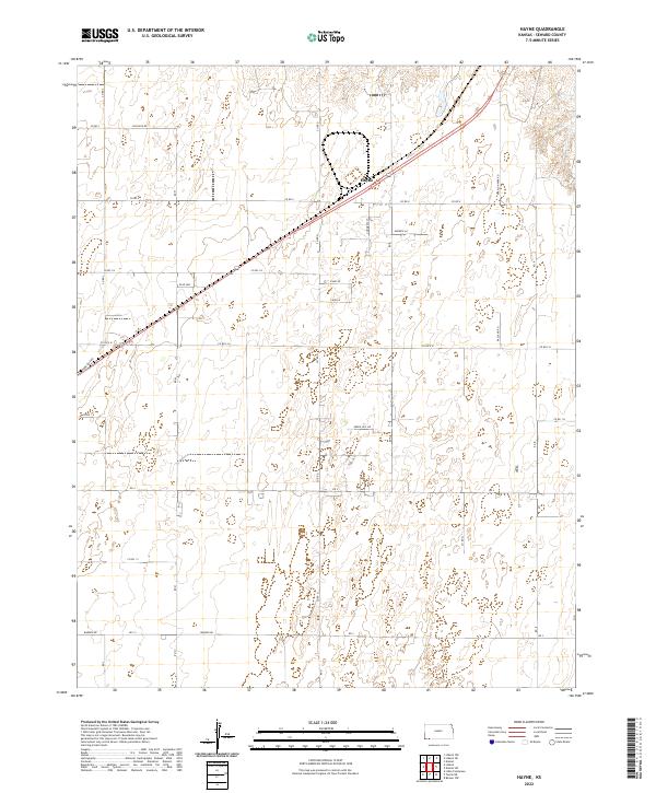
2022 Map of Hayne
USGS Topo · Published 2022About this map
The settlement of Hayne serves as the central hub of this High Plains landscape in Seward County, characterized by a highly organized grid of rural roads and section lines. The township structure is clearly defined by the intersection of t34s r33w and surrounding boundaries, revealing a pattern of large-scale land management typical of Western Kansas. Infrastructure follows both the rigid cardinal directions of the Public Land Survey System and the diagonal trajectory of the primary highway and rail corridor that bisects the area.
Find a feature on this map
32 named features on this map. Tap any name to fly to it.
Don’t see what you’re looking for? This feature index may not catch every label — zoom into the map to look around manually.
Map Details
Editions of this 2022 Hayne Map
This is the sole edition of this map. No revisions or reprints were ever made.
Other maps of this area

1954 · Perryton
USGS Topo · 1:250,000

1955 · Dodge City
USGS Topo · 1:250,000

1958 · Perryton
USGS Topo · 1:250,000

1958 · Dodge City
USGS Topo · 1:250,000

1959 · Dodge City
USGS Topo · 1:250,000

1968 · Liberal NE
USGS Topo · 1:24,000

1968 · Liberal NW
USGS Topo · 1:24,000

1971 · Liberal
USGS Topo · 1:24,000
1971 · Kismet
USGS Topo · 1:24,000

1971 · Kismet SW
USGS Topo · 1:24,000