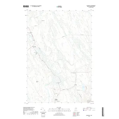
2018 Map of Haynesville
USGS Topo · Published 2018About this map
The Mattawamkeag River and its East Branch carve a winding path through this corner of Aroostook County, anchoring the small settlements of Haynesville and Selden. The landscape is defined by its numerous waterways, including Juniper Brook, Skagrock Brook, and Merrill Brook, which flow through the low-lying wetlands between Mitchel Mtn and Valentine Ridge. Historical continuity is evident in the cluster of burial grounds near the river, such as Riverside Cem and Karnes Gellerson Cem, while the Ferry Bridge crossing suggests the importance of river access to the local transport network. Further south, North Bancroft sits near the base of Shorey Hill, overlooking the intricate drainage of Watson Brook and Little Battle Brook. The presence of several named family cemeteries and isolated ridges like Peekaboo Mtn reflects a deeply rooted, rural community shaped by the terrain of the Maine North Woods.
Find a feature on this map
44 named features on this map. Tap any name to fly to it.
Don’t see what you’re looking for? This feature index may not catch every label — zoom into the map to look around manually.
Map Details
Editions of this 2018 Haynesville Map
This is the sole edition of this map. No revisions or reprints were ever made.
Other maps of this area

1940 · Danforth
USGS Topo · 1:62,500

1940 · Amity
USGS Topo · 1:62,500

1941 · Danforth
USGS Topo · 1:62,500

1941 · Amity
USGS Topo · 1:62,500

1941 · Mattawamkeag Lake
USGS Topo · 1:62,500

1941 · Wytopitlock
USGS Topo · 1:62,500

1943 · Danforth
USGS Topo · 1:62,500

1943 · Wytopitlock
USGS Topo · 1:62,500

1943 · Amity
USGS Topo · 1:62,500

1943 · Mattawamkeag Lake
USGS Topo · 1:62,500