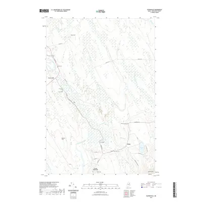
2021 Map of Haynesville
USGS Topo · Published 2021About this map
Haynesville serves as the central hub of this Aroostook County landscape, where the East Branch Mattawamkeag River joins the main stem of the Mattawamkeag River. The settlement pattern follows the river corridor and the historic Military Rd, which is punctuated by small family burial grounds including Blaisdell Cem, Riverside Cem, and the Karnes Gellerson Cem. Further south, the community of North Bancroft sits near the base of Shorey Hill, while Selden lies to the east near Faulkner Lake. The terrain is defined by low ridges and expansive wetlands, with significant high points like Mitchel Mtn and Peekaboo Mtn framing the river valley. Genealogists can trace several remote sites like Tuck Cem and Selden Cem, while the location of Ferry Bridge and Ledge Falls indicates traditional crossing points and navigational markers along the historic river routes of northern Maine.
Find a feature on this map
44 named features on this map. Tap any name to fly to it.
Don’t see what you’re looking for? This feature index may not catch every label — zoom into the map to look around manually.
Map Details
Editions of this 2021 Haynesville Map
This is the sole edition of this map. No revisions or reprints were ever made.
Other maps of this area

1940 · Danforth
USGS Topo · 1:62,500

1940 · Amity
USGS Topo · 1:62,500

1941 · Danforth
USGS Topo · 1:62,500

1941 · Amity
USGS Topo · 1:62,500

1941 · Mattawamkeag Lake
USGS Topo · 1:62,500

1941 · Wytopitlock
USGS Topo · 1:62,500

1943 · Danforth
USGS Topo · 1:62,500

1943 · Wytopitlock
USGS Topo · 1:62,500

1943 · Amity
USGS Topo · 1:62,500

1943 · Mattawamkeag Lake
USGS Topo · 1:62,500