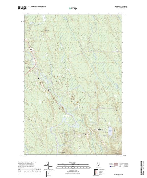
2024 Map of Haynesville
USGS Topo · Published 2024About this map
Haynesville serves as the primary settlement in this stretch of southern Aroostook County, situated where the Military Rd crosses the East Branch Mattawamkeag River. The landscape is defined by the winding course of the Mattawamkeag River and its numerous tributaries, including Juniper Brook and Skagrock Brook. Small clusters of habitation and legacy family sites are evidenced by the high density of rural burial grounds such as Blaisdell Cem, Kames Gellerson Cem, and Tuck Cem. To the southeast, the terrain rises toward Peekaboo Mtn near the small community of Selden and the waters of Faulkner Lake. Roads like Danforth Rd and Original Number Nine Rd trace the historical movement between timberlands and river valleys, while Valentine Ridge provides a prominent natural landmark in the southwestern quadrant.
Find a feature on this map
44 named features on this map. Tap any name to fly to it.
Don’t see what you’re looking for? This feature index may not catch every label — zoom into the map to look around manually.
Map Details
Editions of this 2024 Haynesville Map
This is the sole edition of this map. No revisions or reprints were ever made.
Other maps of this area

1940 · Danforth
USGS Topo · 1:62,500

1940 · Amity
USGS Topo · 1:62,500

1941 · Danforth
USGS Topo · 1:62,500

1941 · Amity
USGS Topo · 1:62,500

1941 · Mattawamkeag Lake
USGS Topo · 1:62,500

1941 · Wytopitlock
USGS Topo · 1:62,500

1943 · Danforth
USGS Topo · 1:62,500

1943 · Wytopitlock
USGS Topo · 1:62,500

1943 · Amity
USGS Topo · 1:62,500

1943 · Mattawamkeag Lake
USGS Topo · 1:62,500