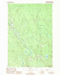
1989 Map of Haynesville
USGS Topo · Published 1989About this map
The Mattawamkeag River snakes through this portion of Aroostook County, serving as the central geographic feature of the Haynesville quadrangle. The settlement of Haynesville itself is located at the junction of several waterways, including the confluence of the East Branch and West Branch. The landscape is defined by its numerous brooks and ridges, such as Valentine Ridge and Mitchel Mtn, which rise above the river valley. To the south, the village of Bancroft and its northern counterpart North Bancroft mark the edge of the inhabited valley near Shorey Hill. This late-1980s data records the rural infrastructure of the era, from a Gravel Pit near the river to a cross-country Pipeline and Transmission Line cutting through the timberland. Local history is anchored by sites like the Cem in Haynesville and the remote settlement of Selden near Faulkner Lake.
Find a feature on this map
36 named features on this map. Tap any name to fly to it.
Don’t see what you’re looking for? This feature index may not catch every label — zoom into the map to look around manually.
Map Details
Editions of this 1989 Haynesville Map
This is the sole edition of this map. No revisions or reprints were ever made.
Other maps of this area

1940 · Danforth
USGS Topo · 1:62,500

1940 · Amity
USGS Topo · 1:62,500

1941 · Danforth
USGS Topo · 1:62,500

1941 · Amity
USGS Topo · 1:62,500

1941 · Mattawamkeag Lake
USGS Topo · 1:62,500

1941 · Wytopitlock
USGS Topo · 1:62,500

1943 · Danforth
USGS Topo · 1:62,500

1943 · Wytopitlock
USGS Topo · 1:62,500

1943 · Amity
USGS Topo · 1:62,500

1943 · Mattawamkeag Lake
USGS Topo · 1:62,500