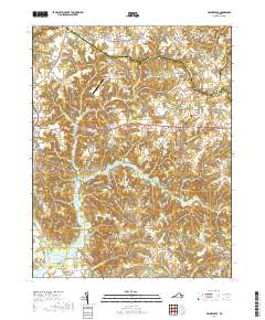
2019 Map of Haynesville
USGS Topo · Published 2019About this map
Haynesville and the surrounding coastal plain of the Northern Neck are defined by the intricate dendritic drainages of the Totuskey Creek watershed. This 2019 survey captures the rural character of Richmond County, where agriculture and woodland are punctuated by historic congregational centers such as Emmanuel Episcopal Church Cem and Jerusalem Baptist Church Cem. The map illustrates the region's enduring reliance on the local bridge network, with crossings at Totuskey Bridge and Drinking Swamp Bridge serving as vital nodes in the local road system.
Find a feature on this map
91 named features on this map. Tap any name to fly to it.
Don’t see what you’re looking for? This feature index may not catch every label — zoom into the map to look around manually.
Map Details
Editions of this 2019 Haynesville Map
This is the sole edition of this map. No revisions or reprints were ever made.
Other maps of this area

1892 · Piney Point
USGS Topo · 1:62,500

1892 · Montross
USGS Topo · 1:62,500

1894 · Piney Point
USGS Topo · 1:62,500

1895 · Nomini
USGS Topo · 1:125,000

1895 · Piney Point
USGS Topo · 1:62,500

1895 · Montross
USGS Topo · 1:62,500

1898 · Nomini
USGS Topo · 1:125,000

1901 · Piney Point
USGS Topo · 1:62,500

1917 · Morattico
USGS Topo · 1:62,500

1918 · Tappahannock
USGS Topo · 1:62,500