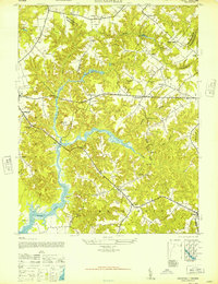
1947 Map of Haynesville
USGS Topo · Published 1947About this map
Totuskey Creek and its many winding tributaries define the landscape of the Virginia Northern Neck as it appeared in the late 1940s. The network of tidal inlets and lowlands, including Marshy Swamp and Drinking Swamp, is bridged at key junctions like the Totuskey Bridge. This survey by the Army Map Service reveals a rural economy still tied to local water resources, evidenced by landmarks such as Gordys Millpond and Moores Mill. Settlements like Haynesville and Emmerton serve as central nodes for the surrounding countryside, while smaller communities such as Lyells and Slash mark the crossroads of Richmond and Westmoreland counties. The density of spiritual and educational centers, including the Good Shepherd Mission and the combined Mulberry Ch and Sch, suggests a series of tight-knit, self-contained rural communities connected by unpaved roads like Waverly Road.
Find a feature on this map
42 named features on this map. Tap any name to fly to it.
Don’t see what you’re looking for? This feature index may not catch every label — zoom into the map to look around manually.
Map Details
Editions of this 1947 Haynesville Map
This is the sole edition of this map. No revisions or reprints were ever made.
Other maps of this area

1892 · Piney Point
USGS Topo · 1:62,500

1892 · Montross
USGS Topo · 1:62,500

1894 · Piney Point
USGS Topo · 1:62,500

1895 · Nomini
USGS Topo · 1:125,000

1895 · Piney Point
USGS Topo · 1:62,500

1895 · Montross
USGS Topo · 1:62,500

1898 · Nomini
USGS Topo · 1:125,000

1901 · Piney Point
USGS Topo · 1:62,500

1917 · Morattico
USGS Topo · 1:62,500

1918 · Tappahannock
USGS Topo · 1:62,500