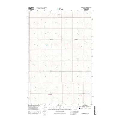
2014 Map of Haynie Reservoir
USGS Topo · Published 2014About this map
Haynie Reservoir sits at the heart of this rangeland survey in McCone Co., Montana. This 2014 mapping by the U.S. Geological Survey shows a landscape defined by seasonal drainages and a sparse network of dirt roads that trace the section lines of the Public Land Survey System. The topography is shaped by the winding paths of Denwoody Cr in the southwest and S Fork Buffalo Cr to the northeast, illustrating the drainage patterns of the Missouri River watershed. Land use is oriented toward remote ranching operations, connected by functional routes like McKean Rd and the descriptively named Pederson Cut Across. The map provides a clear look at the intersection of various townships, including t21n r47e and t20n r48e, highlighting the isolation of the Eastern Montana plains in the early 21st century.
Find a feature on this map
12 named features on this map. Tap any name to fly to it.
Don’t see what you’re looking for? This feature index may not catch every label — zoom into the map to look around manually.
Map Details
Editions of this 2014 Haynie Reservoir Map
This is the sole edition of this map. No revisions or reprints were ever made.
Other maps of this area

1954 · Glendive
USGS Topo · 1:250,000

1957 · Glendive
USGS Topo · 1:250,000

1958 · Glendive
USGS Topo · 1:250,000

1982 · Circle
USGS Topo · 1:100,000

1983 · Youngquist Mine
USGS Topo · 1:24,000

1983 · Brockway NE
USGS Topo · 1:24,000

1983 · Haynie Reservoir
USGS Topo · 1:24,000

1983 · Hudiburgh Reservoir
USGS Topo · 1:24,000

1983 · Pedigo Coulee
USGS Topo · 1:24,000

1983 · North Fork Horse Creek
USGS Topo · 1:24,000