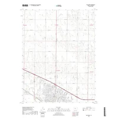
2018 Map of Hays North
USGS Topo · Published 2018About this map
Hays anchors the southern edge of this map, showcasing the city's northward expansion into the high plains of Ellis County. The grid of residential streets like W 33rd St and E 29th St meets the rural agricultural landscape, where drainage follows the winding paths of N Fork Big Cr and Chetolah Cr. The map captures a moment in the city's modern infrastructure, including the Rans Airport west of the main settlement and a network of arterial roads like Catherine Rd and Fairground Rd that connect the urban center to the surrounding farmland.
Find a feature on this map
62 named features on this map. Tap any name to fly to it.
Don’t see what you’re looking for? This feature index may not catch every label — zoom into the map to look around manually.
Map Details
Editions of this 2018 Hays North Map
This is the sole edition of this map. No revisions or reprints were ever made.
Other maps of this area

1896 · Hays
USGS Topo · 1:125,000

1896 · Plainville
USGS Topo · 1:125,000

1955 · Great Bend
USGS Topo · 1:250,000

1955 · Beloit
USGS Topo · 1:250,000

1957 · Great Bend
USGS Topo · 1:250,000

1958 · Great Bend
USGS Topo · 1:250,000

1959 · Beloit
USGS Topo · 1:250,000

1961 · Yocemento
USGS Topo · 1:24,000

1961 · Hays South
USGS Topo · 1:24,000

1961 · Catharine
USGS Topo · 1:24,000