
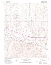
1961 Map of Yocemento
USGS Topo · Published 1962About this map
The Union Pacific railroad and the winding course of Big Creek define the central corridor of this western Kansas landscape, which was surveyed in the early 1960s. The small settlement of Yocemento sits at the heart of the map, established during a brief industrial boom and later serving as a local transit point. The surrounding terrain is divided into the civil townships of Ellis, Buckeye, and Pleasant Hill, revealing a transition from cultivated prairie to the more complex topography of Hog Back.
Find a feature on this map
13 named features on this map. Tap any name to fly to it.
Don’t see what you’re looking for? This feature index may not catch every label — zoom into the map to look around manually.
Map Details
Editions of this 1961 Yocemento Map
2 editions found
Other maps of this area

1893 · Ellis
USGS Topo · 1:125,000

1893 · Hill
USGS Topo · 1:125,000

1896 · Hays
USGS Topo · 1:125,000

1896 · Plainville
USGS Topo · 1:125,000

1955 · Great Bend
USGS Topo · 1:250,000

1955 · Beloit
USGS Topo · 1:250,000

1957 · Great Bend
USGS Topo · 1:250,000

1958 · Great Bend
USGS Topo · 1:250,000

1959 · Beloit
USGS Topo · 1:250,000

1961 · Hays South
USGS Topo · 1:24,000