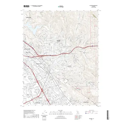
2018 Map of Hayward
USGS Topo · Published 2018About this map
The San Leandro Hills and the western edge of the Diablo Range define the rugged eastern backdrop of this urbanized corridor. Extensive trail networks, such as the Brandon Trail and Loop Trail, wind through the parklands surrounding Lake Chabot, while the lower elevations show the dense residential and commercial expansion of Hayward, San Leandro, and Castro Valley. Institutional landmarks are prominent, including the sprawling campus of California State University - East Bay and the Hayward Executive Airport near the bay plain. The map documents a complex landscape where steep canyons like Dublin Canyon and Eden Canyon press against the built environment. Notable for genealogists are the large historic burial grounds like Holy Sepulchre Cemetery and Lone Tree Cemetery, which serve as significant landmarks within the developed foothills.
Find a feature on this map
84 named features on this map. Tap any name to fly to it.
Don’t see what you’re looking for? This feature index may not catch every label — zoom into the map to look around manually.
Map Details
Editions of this 2018 Hayward Map
This is the sole edition of this map. No revisions or reprints were ever made.
Other maps of this area

1896 · Mt. Diablo
USGS Topo · 1:62,500

1897 · Concord
USGS Topo · 1:62,500

1898 · Mt. Diablo
USGS Topo · 1:62,500

1899 · Haywards
USGS Topo · 1:62,500

1906 · Pleasanton
USGS Topo · 1:62,500

1915 · Haywards
USGS Topo · 1:62,500

1915 · Concord
USGS Topo · 1:62,500

1941 · Pleasanton
USGS Topo · 1:62,500

1942 · Concord
USGS Topo · 1:62,500

1942 · Hayward
USGS Topo · 1:62,500