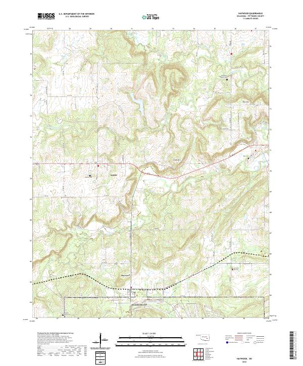
2022 Map of Haywood
USGS Topo · Published 2022About this map
Arpelar and Haywood serve as the primary hubs in this western Pittsburg County landscape, where the terrain transitions from the drainages of Little Wildhorse Creek to the southern elevations of Grubb Mtn. The area is marked by a dense network of sectional roads like N3950 Rd and E1440 Rd, connecting several family and community burial grounds including Arpelar Cem, Blue Cem, and Hickory Grove Cem. Local religious and social history is anchored by the Zion Missionary Baptist Cem and Christian Hill Cem, while the industrial footprint is noted through infrastructure like Oil Well Rd and various active sites. The hydrology is dominated by the winding paths of Coal Cr, Coon Cr, and Deer Cr, which define the low-lying valleys between sandstone ridges.
Find a feature on this map
52 named features on this map. Tap any name to fly to it.
Don’t see what you’re looking for? This feature index may not catch every label — zoom into the map to look around manually.
Map Details
Editions of this 2022 Haywood Map
This is the sole edition of this map. No revisions or reprints were ever made.
Other maps of this area

1896 · Coalgate
USGS Topo · 1:125,000

1898 · McAlester
USGS Topo · 1:125,000

1899 · Coalgate
USGS Topo · 1:125,000

1900 · Canadian
USGS Topo · 1:125,000

1900 · Wewoka
USGS Topo · 1:125,000

1900 · Coalgate
USGS Topo · 1:125,000

1909 · Mc Alester
USGS Topo · 1:125,000

1946 · Fort Smith
USGS Topo · 1:250,000

1950 · Mcalester
USGS Topo · 1:250,000

1954 · Oklahoma City
USGS Topo · 1:250,000