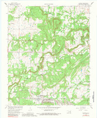
1966 Map of Haywood
USGS Topo · Published 1983About this map
Arpelar and Haywood serve as the primary focal points of this 1966 landscape, situated within a region defined by extensive resource extraction and military presence. Numerous Gas Well sites and a Pipeline network are scattered across the terrain, indicating the era's energy production. To the south, the massive U S Army Ammunition Depot occupies a significant portion of the map, while the Chicago Rock Island and Pacific railroad provides the industrial spine for transport through the county.
Find a feature on this map
26 named features on this map. Tap any name to fly to it.
Don’t see what you’re looking for? This feature index may not catch every label — zoom into the map to look around manually.
Map Details
Editions of this 1966 Haywood Map
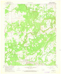
2 editions found
Other maps of this area

1896 · Coalgate
USGS Topo · 1:125,000

1898 · McAlester
USGS Topo · 1:125,000

1899 · Coalgate
USGS Topo · 1:125,000

1900 · Canadian
USGS Topo · 1:125,000

1900 · Wewoka
USGS Topo · 1:125,000

1900 · Coalgate
USGS Topo · 1:125,000

1909 · Mc Alester
USGS Topo · 1:125,000

1946 · Fort Smith
USGS Topo · 1:250,000

1950 · Mcalester
USGS Topo · 1:250,000

1954 · Oklahoma City
USGS Topo · 1:250,000