1900 Map of Canadian
USGS Topo · Published 1900About this map
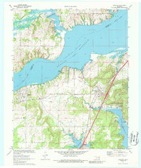
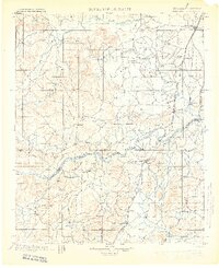
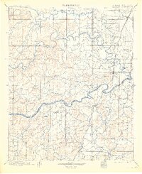
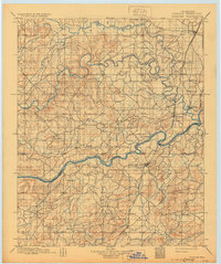
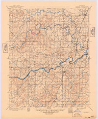
Creek Nation Choctaw Nation Boundary Line bisects this landscape, marking a significant tribal jurisdictional border just years before statehood. The terrain is defined by the convergence of major waterways, including the Deep Fork Canadian River, the North Fork Canadian River, and the primary Canadian River. These meandering rivers created a complex network of bottomlands and ridges that dictated the placement of early Indian Territory settlements. Along the Missouri Kansas and Texas railroad, vital transport hubs like Checotah, Eufaula, and Bond Sta. provided connections to the outside world. To the east, the Cherokee Nation border is visible near Fishertown, while smaller inland communities such as Indianola and Scipio served local agricultural needs. The density of named drainages like Gaines Creek and Coon Creek illustrates a well-watered region where family-named landmarks and small stations formed the backbone of the local economy during the late territorial period.
Find a feature on this map
40 named features on this map. Tap any name to fly to it.
Don’t see what you’re looking for? This feature index may not catch every label — zoom into the map to look around manually.
Map Details
Editions of this 1900 Canadian Map
6 editions found
Historical Maps of Henryetta Through Time
7 maps found